

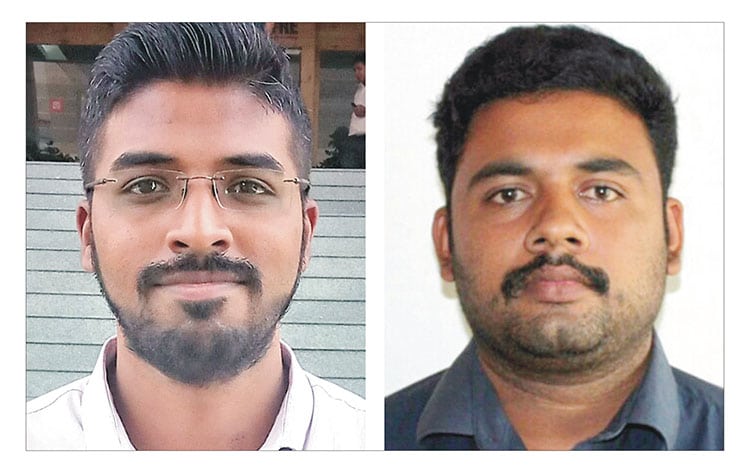
Ananya Vasudev and Jaison Jakob took 28 hours to pin-point the crash site in Arunachal Pradesh
Mysore: A city-based firm has achieved a rare distinction by helping the Indian Air Force (IAF) track down the exact location of the wreckage of the IAF’s AN-32 Military Transport Aircraft that mysteriously went missing on June 3, 2019.
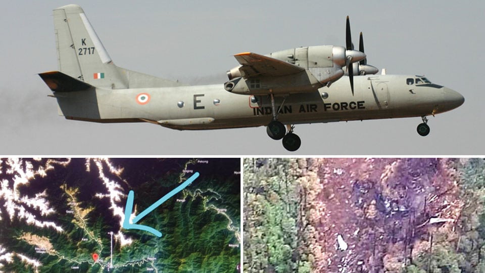
The plane, with 13 people on board, had taken off from Jorhat in Assam at 12.27 pm on June 3 to land at Mechuka Advanced Landing Ground (ALG) in Arunachal Pradesh but lost contact around 1 pm. The wreckage was found at Lipo in Arunachal Pradesh amidst impenetrable jungles. The AN-32 is the largest fleet of military transport aircraft of the IAF.
Massive search operation
After the plane went missing, IAF had launched a massive search operation but could not locate the aircraft. Several aircraft, helicopters and ground teams were deployed in the Search and Rescue (SAR) mission to locate the missing plane. Though many teams were set up in the North East, neither the aircraft was traced nor its crash site.
Desperate to locate the aircraft and its personnel, the IAF sent out an appeal on the fifth day (June 7) to the public requesting help and it had announced phone numbers for the public to contact. The IAF even announced a reward of Rs. 5 lakh for anybody who traces the wreckage and those who give accurate information on the plane’s crash site.
Responding to the IAF plea, Mysuru-based Acqua Geo Consultancy took up the challenge and started work. “Since day one, we were very interested and perplexed on how could the aircraft go off the military radar all of a sudden. We were reading all the news reports and we also knew that multiple agencies were involved in the massive search operation,” R.M. Ananya Vasudev, Director, Geology (Field Operations) Acqua Geo Consultancy said.
Data collection
Speaking to Star of Mysore this morning, Ananya said that they had collected various newspaper and website reports on the missing plane and all the available data including satellite images and satellite-based remote sensing. “There are two types of satellite images — Military and Civilian. While the Military images are not available for the public, we depended on Civilian images. We analysed the area from the aircraft’s take off from Jorhat, climate, direction of the plane’s destination and also wind direction and wind pressure prevailing on June 3,” he said.
After analysing the details, we prepared a report after mapping the route of the missing flight and logically guessed the possible sites where the plane could have crashed. We contacted the number announced by the IAF and we were given a WhatsApp number to share the details. An officer from Karnataka called and he spoke in Kannada. Later an Air Marshal called us and he just announced his rank without revealing his name. The Air Marshal then asked us about the technology used to trace the aircraft in an area of about 2,050 square kilometres,” he explained.
Accurate report
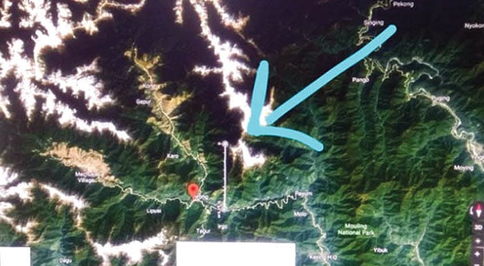
After listening to the team, the Air Marshal told them that over 400 people had sent the reports on the possible location of the crash sites and the report prepared by Acqua Geo Consultancy stood on top and was accurate. “We studied different parameters of wind such as velocity, speed, direction and visibility and depending on these factors we mapped the path further and narrowed down the search place. We identified a Confluence Zone where winds that blow from three directions converge at a particular spot and that was Lipo, where the plane had actually crashed,” said Ananya.
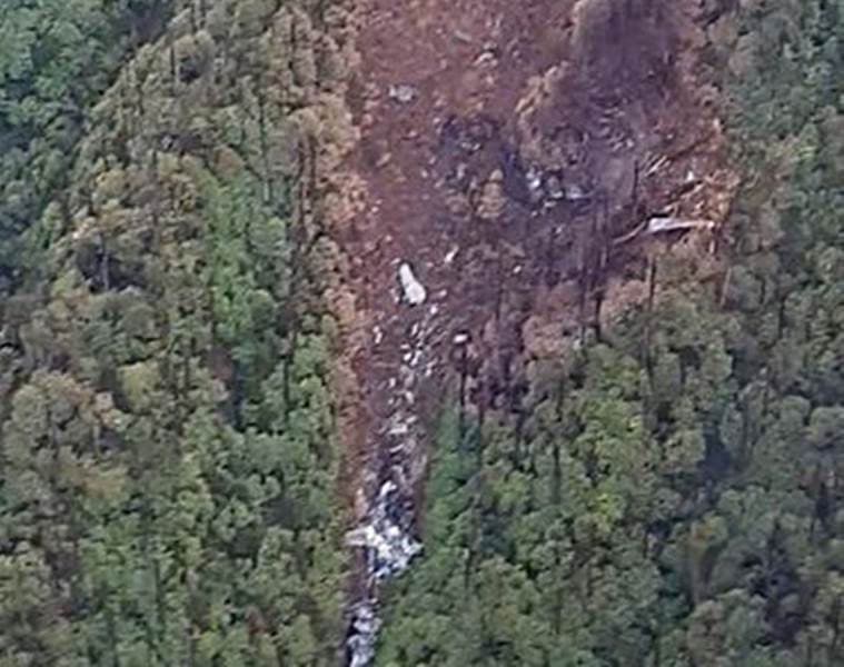
“After we submitted the report, the IAF widened the search operation and more than 1,000 personnel were involved. The wreckage of the aircraft was spotted on June 11, 16 kms north of Lipo, northeast of Tato at an approximate elevation of 12,000 feet by an IAF Mi-17 helicopter undertaking search in the expanded search zone,” he added.
28-hour work
Ananya and Jaison, Director (Planning and Management), Acqua Geo Consultancy, were involved in preparing the report. “It took us 28 hours to analyse the data through satellite-based remote sensing and we did the work voluntarily and we did not do it for any monetary benefits,” Ananya said.
Ananya Vasudev is a geologist and has an extensive field expertise. His has experience in the field of education, rejuvenation of landscapes, lakes, navigation, geochemistry and disaster management. Jaison Jakob is also a geologist and has expertise in the field of structural and engineering geology.


Recent Comments