

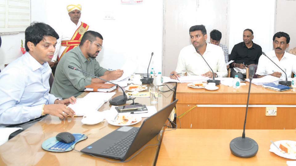
Mysuru: In its general meeting held yesterday, the Mysuru Development Authority (MDA) approved the development of private residential layouts spanning approximately on 400 acres across various parts of Mysuru.
The meeting was chaired by MDA Chairman and Mysuru Deputy Commissioner G. Lakshmikanth Reddy.
The approved areas fall within MDA’s jurisdiction, covering Mysuru city and surrounding regions. Several private developers had earlier submitted applications seeking permission to form residential layouts in these zones and had been awaiting a decision. After detailed discussions, MDA approved their development.
Other major decisions are as follows:
Site allotment to war martyr’s dependent: MDA will allot a free site measuring 40,160 sq. ft. to Aditi G. Muddebihalkar, the dependent of Late Captain M.V. Pranjal, who laid down his life in war/war-like operations. The decision follows the recommendation of the Sainik Welfare Board.
Final deadline for house purchase agreements: Beneficiaries of houses allotted under HUDCO, EWS, LIG, MIG, HIG schemes and bank-assisted projects will be given a final deadline to clear pending instalments with interest and obtain their sale deeds.
Sub-committee for site allocation to achievers: A dedicated sub-committee will review approved applications for site allotments to achievers in categories B, C, D, E, and F, as per the Feb. 8, 2023 notification.
CA sites to Government institutions: Vacant civic amenity sites within MDA limits will be allotted to various Government and Government-owned bodies.
Digitisation and mobile app: All legal cases involving MDA will be systematically digitised. All records in the MDA archives will be digitised. MDA will develop a mobile application to monitor and safeguard its assets.
Approval of 2025–26 technical works budget: Development works worth Rs. 24.4 crore under the Technical Division for 2025–26 received approval.
Revised masterplan for Mysuru–Nanjangud region: MDA will submit expanded boundary details of the Mysuru–Nanjangud Local Planning Area for government approval and prepare a revised master plan under the AMRUT scheme using GIS mapping.


Recent Comments