

Come April 2026, City Corporation to roll out advanced technology for accurate data, curb building violations, boost tax revenue
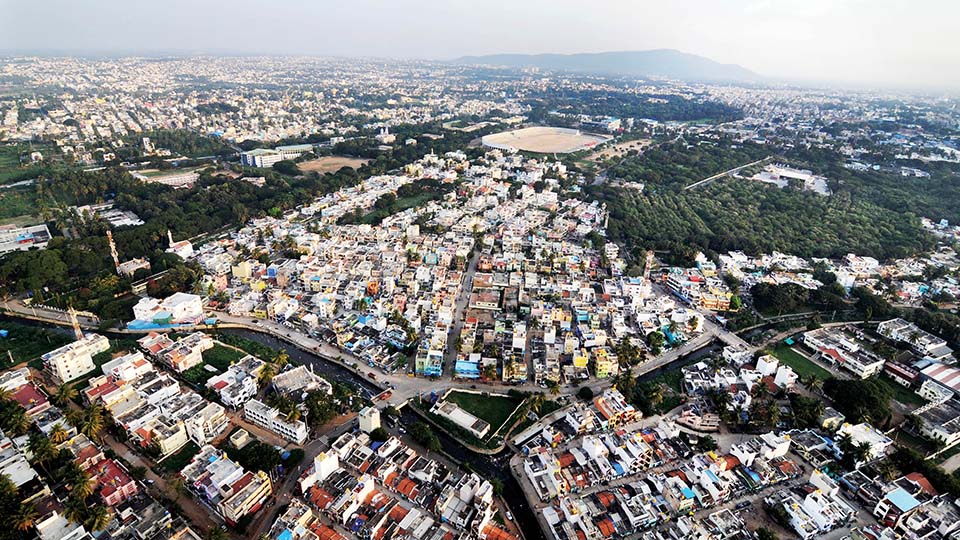
Mysore/Mysuru: In a first for Mysuru, the Mysuru City Corporation (MCC) is set to implement Aerial LiDAR (Light Detection And Ranging) technology from April 2026 to gather highly accurate data on property boundaries, building dimensions, number of floors, land use changes, lakes, drains (nalas) and other water bodies — a move aimed at tackling illegal encroachments and improving tax assessments.
Preparations are already underway at the MCC to roll out this advanced technology. “With LiDAR-based GIS property mapping, we can ensure accurate property assessments. This technology will enable us to precisely measure property sizes and structures, leading to fairer tax rates and improved revenue generation,” MCC Commissioner Shaikh Tanveer Asif told Star of Mysore this morning.
More accurate than traditional surveys
Traditional survey and mapping methods depend on manual inspections or outdated aerial photographs, often missing smaller details and resulting in inaccurate assessments. “LiDAR will allow us to identify new or unreported structures, ensuring that every taxable property is accounted for,” he explained.
MCC Commissioner Shaikh Tanveer Asif highlighted that many property owners fail to report changes, such as additional floors or structural alterations, leading to under-taxation.
“There are hundreds of building violations within MCC limits that have escaped our notice — like excess floors built in violation of norms, non-compliance with setback rules and breaches of Floor Area Ratio (FAR). These not only violate urban planning rules but also cause significant revenue loss to the MCC,” he said.
Tracking zoning and land use changes
Currently, zoning changes are tracked using planning records or manual inspections, which are often outdated and slow. “LiDAR will help us monitor zoning shifts, land development and urban expansion in real time. This will allow us to revise taxes more effectively and take corrective action quickly,” Asif added.
The MCC has already digitised property records through the e-Aasthi application, issuing 52,827 e-Khatas, including 48,125 A-Khatas and 4,701 B-Khatas. “With LiDAR mapping, we expect to generate Property Tax revenues of around Rs. 400 crore, which will significantly strengthen MCC’s financial position,” the Commissioner stated.
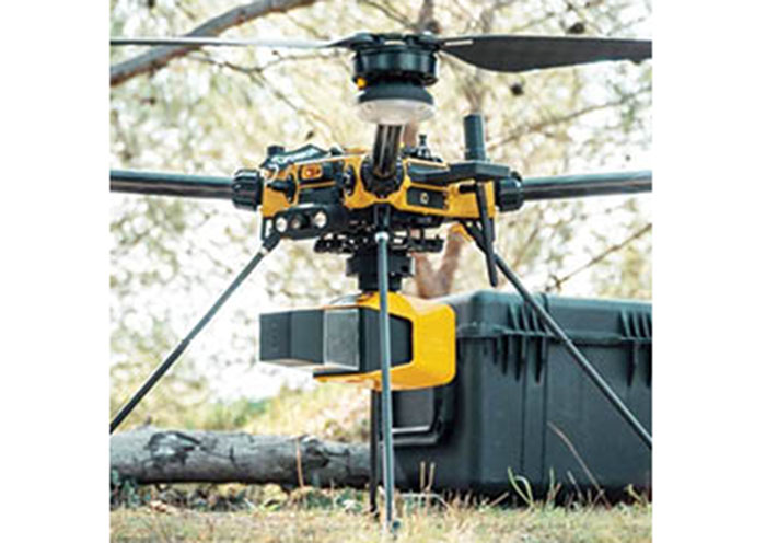
How Aerial LiDAR Works
Aerial LiDAR works by emitting thousands of laser pulses per second from a sensor mounted on an aircraft, drone or helicopter. These pulses travel to the ground and bounce off surfaces such as trees, buildings and terrain.
The sensor records the time it takes for each pulse to return, enabling highly precise distance calculations. This data is then used to create a dense 3D point cloud that maps the contours and features of the landscape in remarkable detail. What makes aerial LiDAR especially powerful is its centimetre-level accuracy and speed. Unlike traditional ground surveys, it can cover large areas quickly while capturing fine surface details often missed by conventional methods.

Recent Comments