

Experts’ team submits primary report; blames excessive human intervention in eco-sensitive area
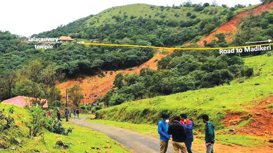
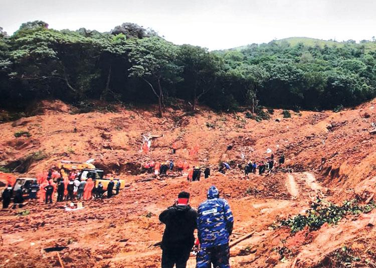
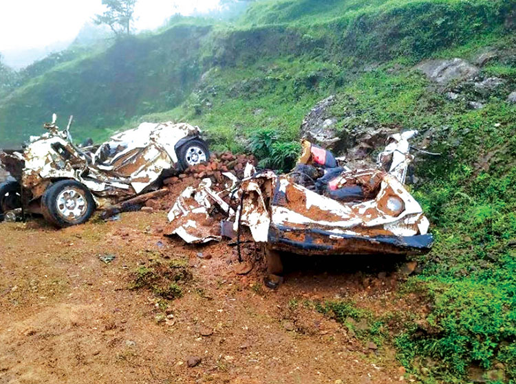
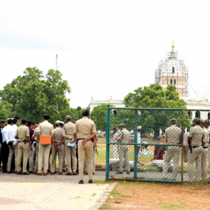
Madikeri: The Geological Survey of India (GSI) has submitted its primary report on the devastating landslip on the night of Aug. 5 this year where two houses at the foothills of Gajagiri Hill (Brahmagiri Hill Range) with its residents, including the chief priest of the Talacauvery Temple were swept away and vast swathes of coffee plantations were buried under the debris.
The 16-page report prepared by Kapil Singh and Kamal Kumar was submitted to the Kodagu District Administration recently. The team studied the landslide pattern after Kodagu DC requested it to do so and visited the landslide areas on Aug. 14 and 15.
The team was entrusted with the responsibility of assessment of the nature, causes, the future risk and vulnerability at the landslide sites and also suggesting remedial measures — both immediate and long term.
After extensive survey of the hill range and an analysis of the causes, the GSI team has opined that cracks caused by old landslides at Gajagiri Hill, multiple contour trenches made by the Department of Forest at the mid-slope for conservation of water, increased human interference in this ecologically sensitive area, unscientific road construction works and beyond normal rainfall caused the devastating landslip.
The team has pointed out that before the major landslide on Aug. 5 midnight, Gajagiri Hill had developed cracks as there were minor landslides earlier. Gajagiri Hill is a part of Brahmagiri Hill Range spread across Karnataka-Kerala border with Kodagu to the North and Wayanad to the South.
Cracks (chasms) on the Gajagiri Hill were getting wider and deeper, thus posing a threat to the houses of priests located at the foot of the hill. This factor where the areas witnessed multiple reactivations was overlooked and thereby the land slid, the team opined.
The ground cracks and contour trenches dug by the Forest Department on the slope acted as pathway for water infiltration during heavy rains, which resulted in increased hydrostatic pressure. This resulted in decreased shear strength of the spot and triggered the reactivation of landslide spot, the team reported.
These contour trenches are aligned parallel to the crack that developed earlier. This has allowed infiltration of water into the overburdened material. Slope cut for road expansion have been left unsupported and these factors caused the land to slide, the GSI team mentioned in its report.
“Over 50 – 60 percolation pits and trenches were created there using excavators. Heavy machinery such as backhoes was used to level slopes for construction of structures, including stairways and car parking. The work, along with other activities in the area, led to loosening of the soil, which, in turn impacted the hill’s natural drainage system. And a record rain of 172 mm on Aug. 4, 185 mm on Aug. 5 and 478mm on Aug. 6 was naturally the trigger for landslides,” the GSI experts team report said.
Remedial measures suggested by GSI team
Approach road to Talacauvery Temple should be designed in a way to withstand heavy rain.
Appropriately designed retaining structures of suitable height with firm foundation are required to be erected from road level for checking slope failure.
There should be proper and adequate drainage arrangements in the form of well-designed drains and culverts along the road to keep the slope well drained.
Drainage system along the road should be supported by concrete work. Excavation on slope should not be allowed.
Any trenches or cracks, if present on the slope should be monitored and filled up with impervious material to restrict any infiltration of water.
The debris accumulated on the failure surface can be eased by proper benching and planting of deep rooted plants or vetiver grass.
Disrupted drainage pathways should be restored or re-engineered to prevent future water build-up in the slide mass.
Residents living in and around Brahmagiri Hills are advised to keep safe distance from the vulnerable slope and vacate the area, especially during heavy or prolonged rainfall.
It is not advisable to rehabilitate this landslide-affected zone till the slope is stabilised to the best possible extent.
Recent Comments