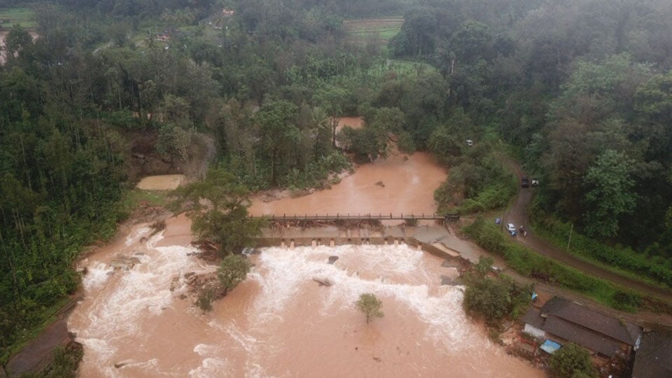
After a series of reports that pointed accusing fingers at extensive and unabated human interference, here is another report that says human exploitation of nature and heavy rains were the two main reasons for the catastrophic-proportion landslides and floods in Kodagu. This time, the report is official and has been presented by Geological Survey of India, a government body.
The Geological Survey of India (GSI) team, comprising K.V. Maruthi, Director, and Senior Geologists Ankur Kumar Srivastava and Sunandan Basu, has prepared a comprehensive report after visiting the devastation-hit parts of Kodagu from Aug. 27 to Sept. 1.
The team was entrusted with the responsibility of assessment of the nature, causes, the future risk and vulnerability at the landslide sites and also suggesting remedial measures — both immediate and long term. Notably, the GSI team has not ruled out future landslides and has asked the administration to prepare properly for any such eventuality. The report has now been presented to the Kodagu Deputy Commissioner.
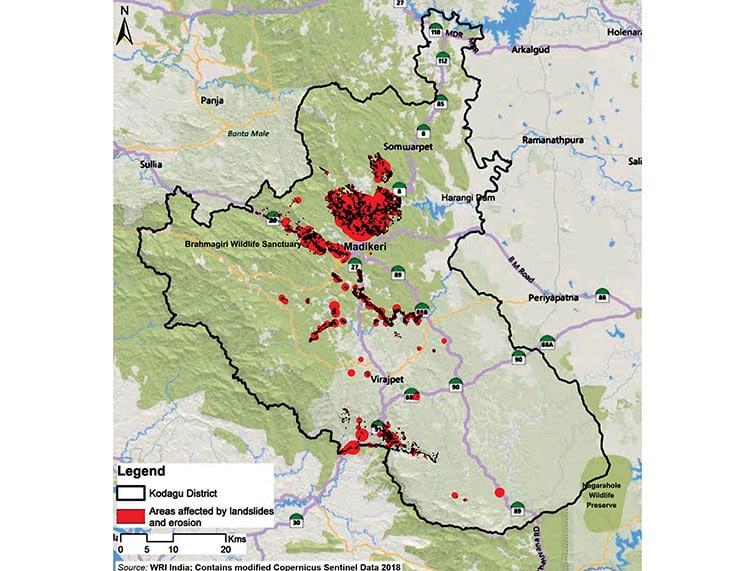
The GSI team compiled a 150-page report of 105 landslips in Kodagu. Of this, researchers had visited 85 spots and found that a majority of these are along the lineament (a geological feature which is an expression of faults and fold-aligned hills).

LAND MODIFICATION
The report clearly mentions that modification of land for construction of infrastructure like houses, hotels, home stays etc., large-scale slope modification for plantation (especially coffee) are very common in Kodagu. “These slope modifications actually decrease the slope stability and later with the water percolation due to heavy rain, the slope becomes unstable and prone to landslides,” the report observed.
“The main reason for devastation is rainfall and the slope modification by human interference. There are no guidelines or land-use regulations to monitor the lands in the area. The State government along with State Disaster Management Authority should henceforth frame strict guidelines/regulations for land-use in hilly terrains of Western Ghats in general and Kodagu district in particular,” the report said.
Considering the average annual rainfall in the area, recurrence of such events is not ruled out and proper preparedness for such events is must, the Geologists observed. Numerous houses are constructed at different levels of slope modifying the natural slope in all the landslide-hit areas.
DESTRUCTION OF SLOPES
“During high water precipitation in monsoon, huge volume of water flowed from upslope towards down slope but in many places the courses were blocked due to either construction of houses or plantations. But as the water volume kept on increasing, the water pressure on the surfaces got so intense that it could not hold the water resulting in slope failures and damages of properties,” the report said.
Slopes, especially along Madikeri, Sullia, Kaloor, Vanachalu, Galibeedu, Paanathur, Bhagamandala, Talacauvery, Korangala, Makkandur, Mukkodlu, Meghathalu, Yemmethaalu, Makutta, Hattihole and Madapura have been cut, bored and sliced in the name of development, the Geologists analysed.
Armed with photographic evidence of extensive exploitation in the name of development, the Geologists showed how slopes have been modified extensively for plantations and construction of houses and in the process how these constructions blocked the natural drainage. This has led to landslides and the runoff has come down along the drainage course to damage the plantation and houses, the GSI team opined.
EARTHQUAKE CAUSE RULED OUT
Dismissing the reports of earthquake-triggered landslides, the Geologists stated that the theory of development of surface cracks after an earthquake is not a valid one. It is very hard to explain that a 3.4 magnitude earthquake occurred a month ago in July (before the floods and landslides in August) would trigger so many landslides and there are no conclusive evidences of earthquake-induced landslides. “These landslides are mostly triggered by rainfall and the geo-scientific causes are slope modifications along with increase of pore pressure and decrease of internal friction of the slope-forming material,” the report observed.
RECOMMENDATIONS
The recommendations of the GSI team includes slope stability measures like retaining wall slope terracing, drainage maintenance, public awareness programmes and possible shifting of residential areas to more stable zones.
The team has suggested identifying landslide-prone areas and buffer zones and highlighting what kind of activities can be allowed in these zones. Plans and policies must be formed for land-use management for sustainable development.
“An assessment of the cut slope stability in the hilly area should be carried out for predicting instability which will be helpful for town planning and developmental activities. For all future cuttings in slopes of this kind, proper guidance of a Geologist/ Structural Engineer may be sought,” the report recommended.
“We have strongly recommended to the State government to have some legal restrictions and regulations in these landslip-prone areas. This is needed to ensure land use is not changed or new constructions are regulated,” said K.V. Maruthi.
Vertical cut slopes should be avoided in future as it destabilises the slope. Due care should be given to the cut slopes made for road construction and plantations during cutting of the slope by following proper slope stability practices. The cut slopes may be provided with suitable retaining structures along with proper drainage facilities, the report has said.
WHAT THE GEOLOGISTS SAID
- Human exploitation of nature & heavy rains caused catastrophic landslides and floods in Kodagu
- Future landslides not ruled out. The District Administration must be prepared properly for any such eventuality
- The main reason for devastation is rainfall and the slope modification by human interference
- Reports of earthquake-triggered landslides dismissed as there are no conclusive evidences


Recent Comments