Mysuru/Madikeri: For the third successive year, heavy rains are expected in Kodagu, its adjoining districts, Coastal Karnataka and Kerala starting from today (Aug. 3), predicted Tamil Nadu Weatherman.
Incidentally, it has been raining in Kodagu since the last two days and the India Metrological Department (IMD) too has forecast heavy to very heavy rainfall in Kodagu for the four to five days.
The Tamil Nadu Weatherman’s prediction says that Kodagu and Kerala received maximum rainfall in the month of August in 2018 and 2019, literally destroying vast swathes of land and rendered thousands of people homeless. Mountains were brought down, houses crumbled and rivers changed course due to flash floods and landslides.
“Particularly in 2019, the rainfall shifted from drought to excess rainfall in such a short period and most of the dams started overflowing. This trend will continue this year too,” says Pradeep John, the man behind Tamil Nadu Weatherman, the portal that covers interesting weather events in India, particularly in Karnataka, Kerala and Tamil Nadu.
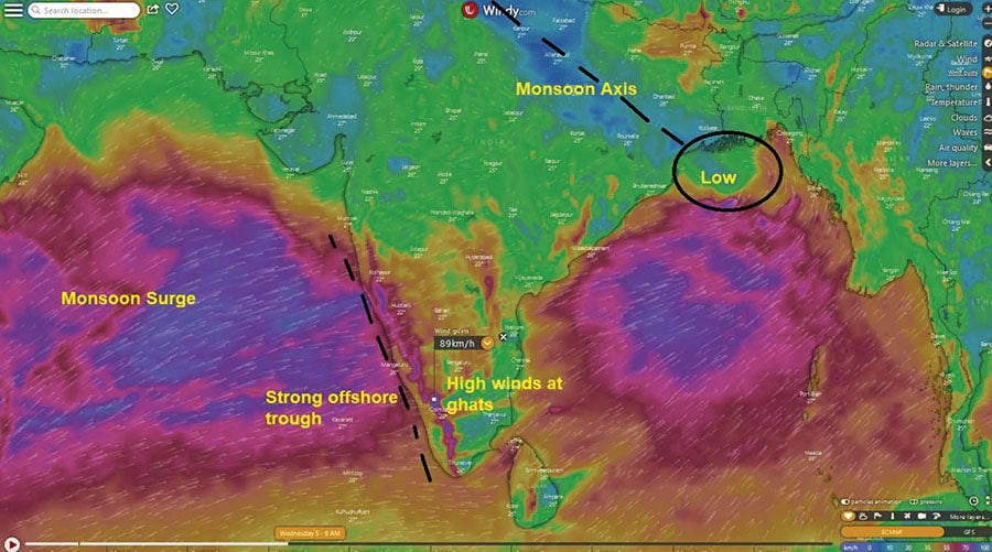
Like 2018 and 2019, Kerala and Karnataka received less rainfall in the month of May, June and July and drought-like condition prevailed. “In August, however, things changed and maximum rainfall has been received, coupled with destruction. This year too, it will rain heavily in August as a low pressure area has been formed in peninsular India. There will be a surge in monsoon with strong offshore trough and high winds at ghats,” the prediction says.

What is monsoon trough
As an effect of low pressure formation and its passage along the trough, strong wind currents form over the west coast. These currents are blocked by Sayhadri Mountains resulting in formation of offshore trough. Hence, due to this offshore trough, west of coast of India receives good rain (SEE PHOTO).
First low pressure area
“Till date not even a single low pressure has formed in the core monsoon region and this is the first low pressure area which has formed in North Bay and then moves into core monsoon zone. It will be followed by next low pressure in the second week of August.
Whenever a low pressure area forms and moves inland from Bay of Bengal via Odisha, Madhya Pradesh, Maharashtra and Gujarat, it activates monsoon winds in Arabian Sea side and creates strong offshore trough. The first low pressure lasts till Aug. 8 or 9 followed by next low pressure which forms immediately,” the Tamil Nadu Weatherman’s prediction says.
Yellow alert in Kodagu
In Kodagu, according to the prediction, Talacauvery, Bhagamandala, Naladi, Soorlabbi, Madapura and adjoining areas like Hattihole, Yemmethaalu, Kaloor, Thantipaala, Madikeri, and Mukkodlu will be the hotspots. It may be mentioned here that these areas received the highest rainfall in the last two years.
The IMD yesterday issued yellow and orange alert for several districts in Kerala for the next four days (Monday onwards). The IMD website also indicates the formation of a low-pressure area over North Bay of Bengal towards the later part of the first week of August and says it’s likely to intensify over north-west Bay of Bengal off Odisha coast at the end of the first week.
In Kodagu, yellow alert has been declared by the District Administration till Aug. 4 and orange alert has been sounded till Aug. 7. The District Authorities have alerted people living in low-lying areas and those living on the river banks to move to safer areas. The National Disaster Response Force (NDRF) teams that are stationed in Kodagu too have been put on high alert.
The Orange alert indicates heavy to very heavy rainfall, while yellow warning indicates moderate rain is expected. The Red alert is the most serious kind of weather warning which indicates the weather is likely to cause damage.
August 2018 rain in Kodagu broke 87-year-old record
Kodagu district received the highest-ever rainfall for August 2018, surpassing an 87-year-old record. It was in 1931 that the district received 1,559 mm rain during the entire month. However, in the first three weeks of August alone, the district received a total rainfall of 1,675 mm (till August 21).
The data from India Meteorological Department, Bengaluru, showed 45 percent (768mm) of the record August rainfall was received within three days — August 15, 16 and 17, 2018. Such a huge quantity of rain within a short duration was the reason behind large-scale damages in the district.
If the rain quantity exceeds more than 200mm in a day, it is termed extremely heavy rainfall. Kodagu received the highest-ever daily rainfall when it recorded 300mm in a single day on August 17.


This article is very poorly written and does not do justice to the high quality of reporting normally seen in Star of Mysore.
Four of many instances that would make this article informative and readable are:
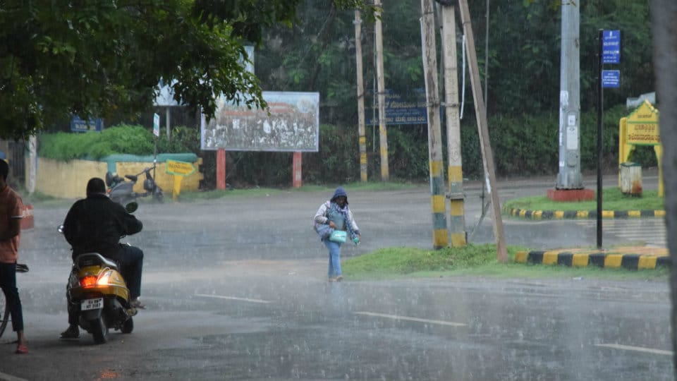
1. The picture that is shown appeared last year in a monsoon realted article. Is the reporter so lazy to not have a ‘current’ picture?
2. The second para starts with “Incidentally, it has been raining in Kodagu since the last two days and the India Metrological Department (IMD) too has forecast heavy to very heavy rainfall in Kodagu for the four to five days.” The fact is that it has been raining quite heavily in Kodagu since July and the sentence has poor grammar.
3. Paragraph 3 states ‘Mountains were brought down, houses crumbled and rivers changed course due to flash floods and landslides’. In reality ‘Mountains’ were not brought down, instead there were Mountain slides which are still quite devastating.
4. Paragraph six is also poorly composed and references the article’s photo as if it is a current picture, which it is not!
Please read the article a couple of times, check for grammar, clarity of information, validity of assertion etc., before submitting for publication.